| Campo DC | Valor | Lengua/Idioma |
|---|
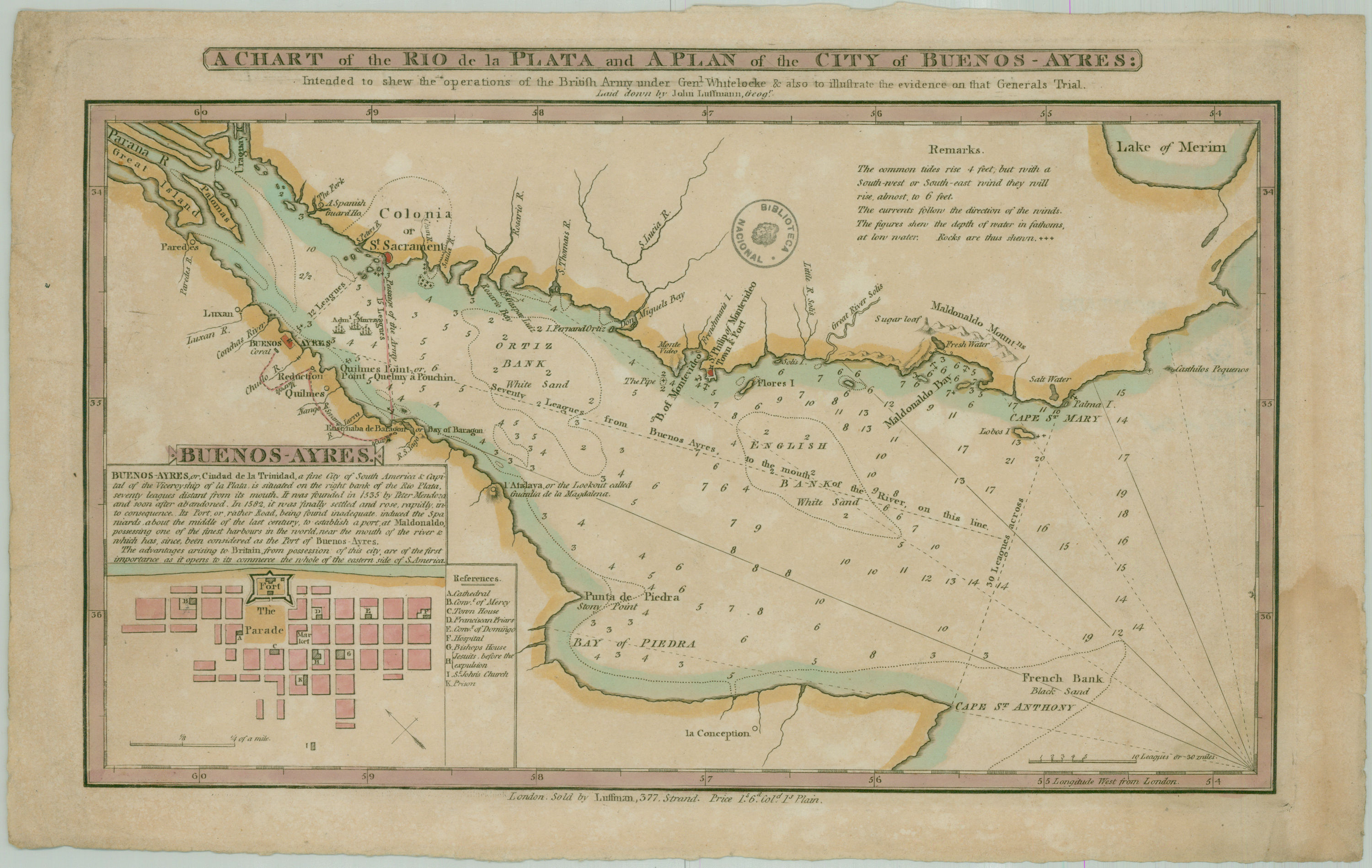
| dc.coverage.spatial | Río de la Plata (Región) | - |
| dc.creator | Luffmann, John | - |
| dc.date.issued | 1800 | - |
| dc.identifier.uri | http://bibliotecadigital.bibna.gub.uy/jspui/handle/123456789/6265 | - |
| dc.description | Escala 10 leguas o 3 millas | - |
| dc.description | En recuadro: Plano de la ciudad de Buenos Aires con referencias | - |
| dc.format | image/jpg | - |
| dc.format.extent | 1 mapa :col. ;23 x 38 cm | - |
| dc.publisher | [s.n.] | - |
| dc.subject | Invasiones Inglesas - 1806-1807 | - |
| dc.title | A chart of the Rio de la Plata and a plan of the city of Buenos Ayres intended to shew the operations of the British Army under Gen. Whitelocke and also to illustrate the evidence on that Generals Trial. | - |
| dc.type | mapa | - |
| Aparece en las colecciones: | Siglo 19 (Río de la Plata)
|