| Campo DC | Valor | Lengua/Idioma |
|---|
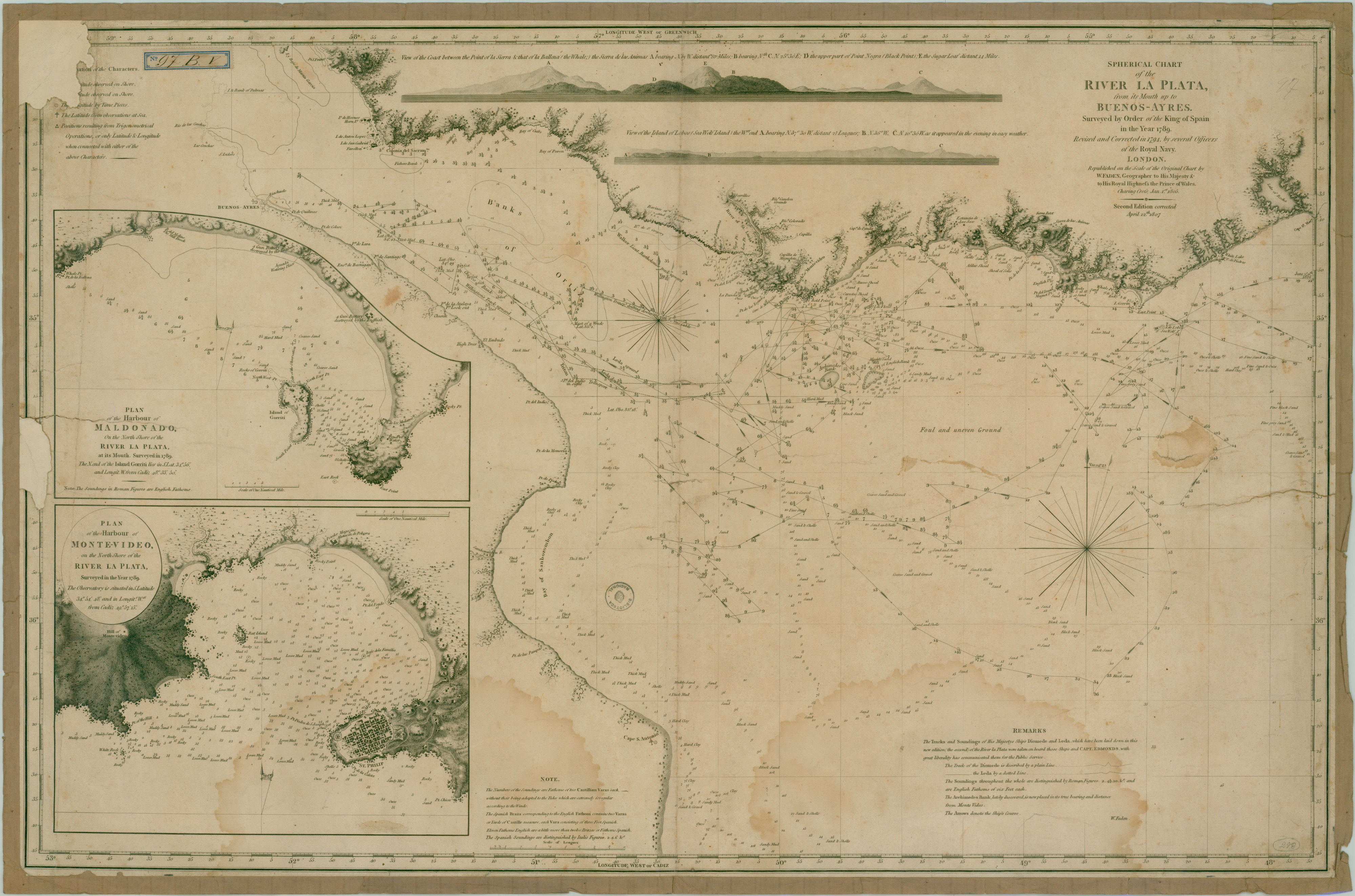
| dc.coverage.spatial | Río de la Plata (Región) | - |
| dc.creator | Faden, William | - |
| dc.date.issued | 1807 | - |
| dc.identifier.uri | http://bibliotecadigital.bibna.gub.uy/jspui/handle/123456789/6280 | - |
| dc.description | Escala en leguas | - |
| dc.description | 2a. ed. corregida | - |
| dc.description | W. Faden, geographer to his Majesty the King and the Prince of Wales. Charing Cross Jan. 1805 | - |
| dc.description | En recuadro: Plan of the harbour of Maldonado on the North Shore of the River La Plata, at its Mouth. Surveyed in 1789.Plan of the harbour of Monte-video, on the North Shore of the River La Plata, surveyed in the year 1789 | - |
| dc.format | image/jpg | - |
| dc.format.extent | 1 plano :byn., cartulina ;66 x 58 cm | - |
| dc.publisher | W. Faden | - |
| dc.title | Spherical chart of the River La Plata from its Mouth up to Buenos-Ayres. Surveyed by order of the King of Spain in the year 1789. Revised and corrected in 1794, by several officers of the Royal Navy | - |
| dc.type | mapa | - |
| Aparece en las colecciones: | Siglo 19 (Río de la Plata)
|