Registro completo de metadatos
| Campo DC | Valor | Lengua/Idioma |
|---|
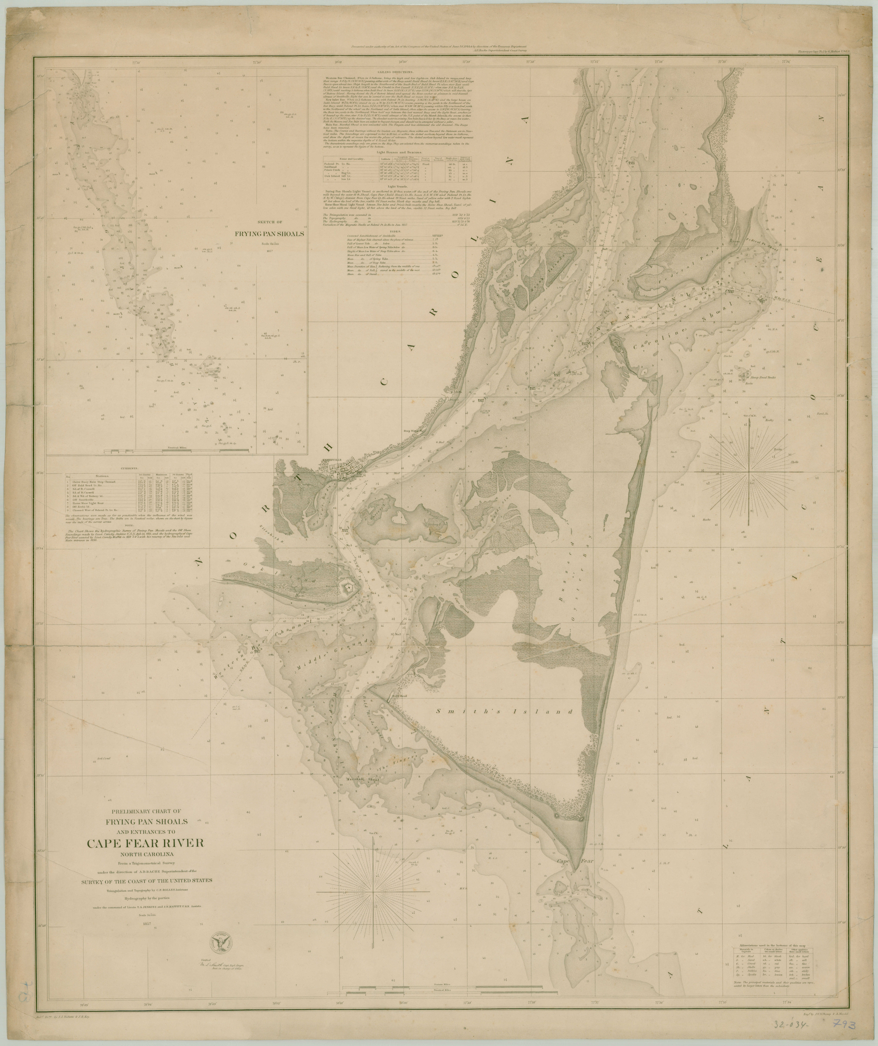
| dc.coverage.spatial | Carolina del Norte (Estados Unidos : Estado) | - |
| dc.creator | Bolles, C.P | - |
| dc.date.issued | 1857 | - |
| dc.identifier.uri | http://bibliotecadigital.bibna.gub.uy/jspui/handle/123456789/4926 | - |
| dc.description | Escala 1:30.000 | - |
| dc.format | image/jpg | - |
| dc.format.extent | 1 mapa ;68 x 42 cm | - |
| dc.publisher | SCUS | - |
| dc.title | Preliminary chart of frying pan shoals and entrances to Cape Fear river North Carolina | - |
| dc.type | mapa | - |
| Aparece en las colecciones: | América - Siglo 19 (Mapas)
|