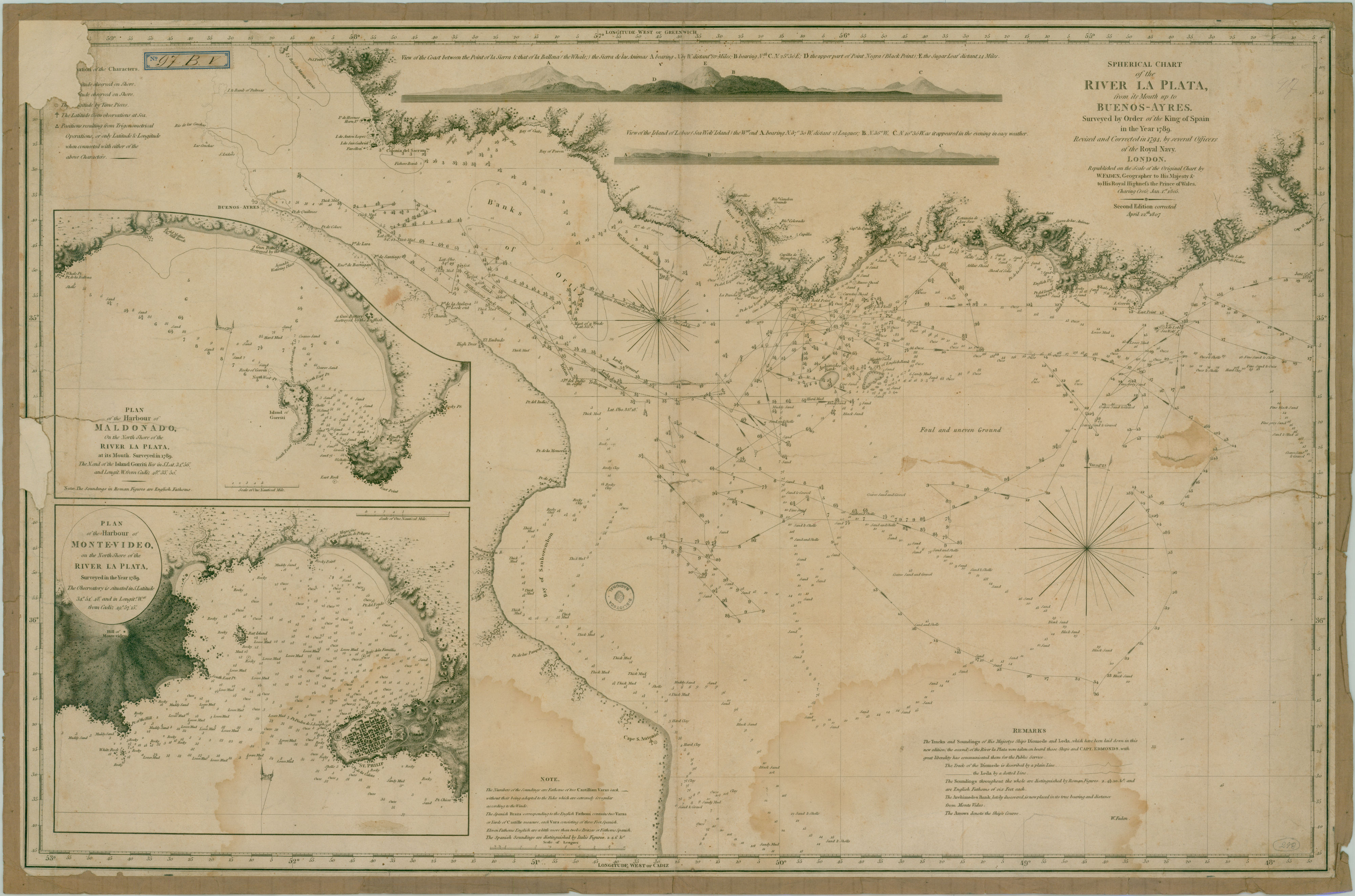
| Título : | Spherical chart of the River La Plata from its Mouth up to Buenos-Ayres. Surveyed by order of the King of Spain in the year 1789. Revised and corrected in 1794, by several officers of the Royal Navy |
| Editorial : | W. Faden |
| Fecha de publicación : | 1807 |
| Descripción : | Escala en leguas 2a. ed. corregida W. Faden, geographer to his Majesty the King and the Prince of Wales. Charing Cross Jan. 1805 En recuadro: Plan of the harbour of Maldonado on the North Shore of the River La Plata, at its Mouth. Surveyed in 1789.Plan of the harbour of Monte-video, on the North Shore of the River La Plata, surveyed in the year 1789 |
| Aparece en las colecciones: | Siglo 19 (Río de la Plata) |
| Fichero | I.01.094.G.5340.1807.F3.jpg |
| Tamaño | 1,75 MB |
| Formato | JPEG |
| Licencia | Abrir | Fichero | I.01.094.G.5340.1807.F3.original.jpg |
| Tamaño | 86,52 MB |
| Formato | JPEG |
| Licencia | Abrir |